|
Issued: 0530hrs Tuesday 20th February 2018
Duty forecaster: Matthew Hugo
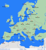
 Cold, if not very cold weather will develop across northern areas of Europe, unsettled and milder in the south Cold, if not very cold weather will develop across northern areas of Europe, unsettled and milder in the south
Tuesday
Through into Tuesday and low pressure remains slow moving through much of the Med bringing a particularly disturbed period of weather here with heavy rain, downpours, local thunder and along with some significant snowfall for the Alps. Parts of Italy in particular look set to see some significant rainfall totals, while heavy showers and thunderstorms extend eastwards towards Greece and surrounding areas. High pressure is more influential across northern areas of Europe, but with some flurries across Poland and up towards Finland and Sweden where very cold weather will develop through the day with some particularly extreme minimum temperatures likely on Tuesday night.
 Wednesday Wednesday
Into Wednesday and high pressure becomes influential across much of England, Wales, Ireland and Scotland leading to drier and colder conditions. Equally high pressure is expected across much of Scandinavia, with some very cold weather developing across Sweden and Finland in particular, bitterly cold in fact with snow flurries here and also with some flurries extending down into Poland and some other eastern areas of Europe. Germany and more central areas of Europe will be cold and dry with some sunny spells and a cold E'ly wind. Similarly rather cold but mainly dry across much of Spain and Portugal. However, much of the Med, especially in and around Italy will continue to be dominated by low pressure bringing showers, longer spells of rain, local thunderstorms and some snow to the Alps.
|
